
When we set out to spend two weeks travelling independently through North Macedonia, our plan was simple: explore the cities and historical sites but also dive into the country’s wild landscapes. Buses and the occasional taxi carried us across the country, while our hiking boots took us into the mountains in search of the best day hikes in North Macedonia.
We were also looking for some mountain training ahead of a research trip to Switzerland later that year. What we wanted were proper trails with some altitude. In the end, we managed to do three very different day hikes in three different national parks: Shar Mountains National Park near Tetovo, Mavrovo National Park, and Pelister National Park near Bitola.
This post gives an overview of the North Macedonian hiking trails we did, along with some useful information to help you experience them for yourself.
Exploring the Shar Mountains from Popova Shapka
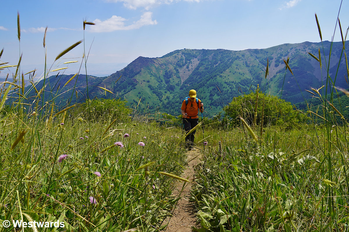
Hike to the Antenna viewpoint, 12,5 km, 900 m up and 900 m down.
Shar Mountains National Park was declared North Macedonia’s fourth national park in 2021. The mountain range stretches across both North Macedonia and Kosovo, offering alpine meadows, high ridges, and sweeping views above the tree line. It’s perfect for anyone looking for day hikes in North Macedonia as it is not too far away from the capital, Skopje.
Getting to Popova Shapka
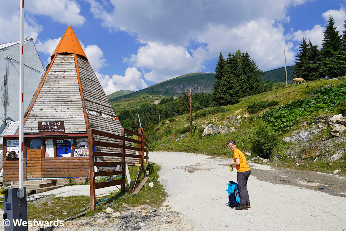
A popular starting point for hikes in the Shar Mountains is Popova Shapka. This is not really a village but mainly a ski resort perched about 1,000 meters above Tetovo. At least in summer there is no public transport. We took a taxi up early in the morning and arrived around 9 a.m. Off-season, Popova Shapka has a quiet, almost deserted feel – rows of closed hotels and empty parking lots – though the Hotel Scardus is open year-round and serves as a base for summer hikers.
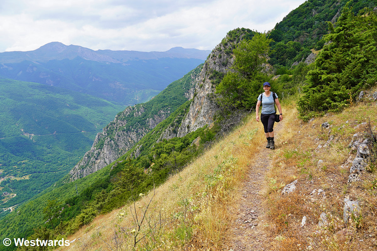
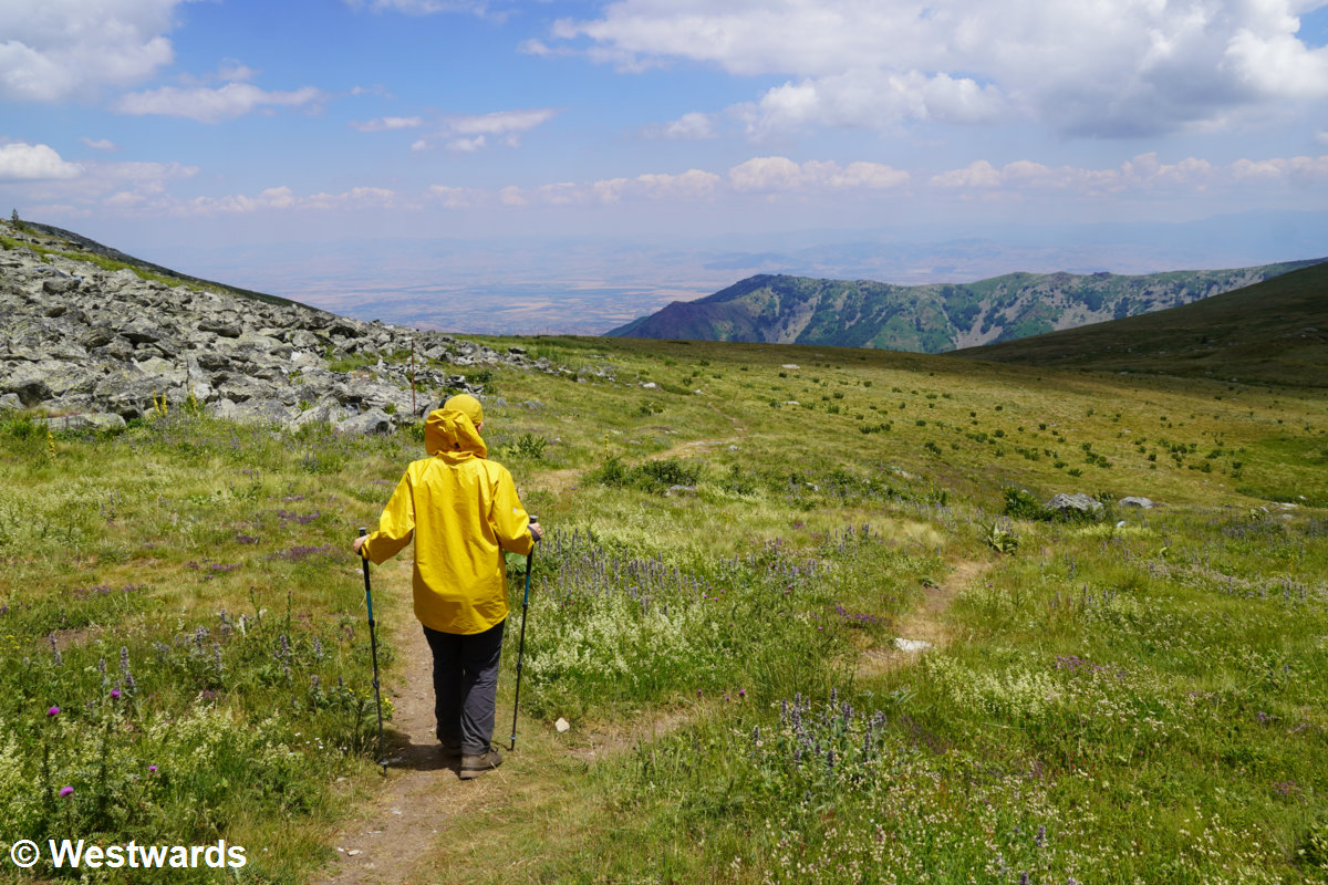
Hiking to the Antenna viewpoint
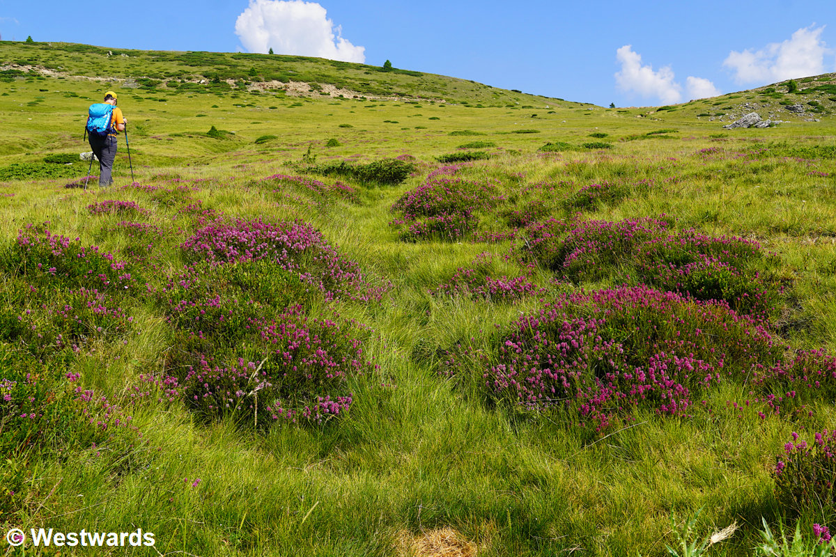
We had downloaded GPS tracks for a loop leading up to a small summit known locally as Antenna, a modest peak crowned with a television mast. The trail begins gently, crossing open meadows where cows graze, before veering steeply off-trail through alpine grassland and juniper. The ascent is quite demanding – first over a rounded knoll, then unrelentingly upward toward a ski lift station. Soon we are well above the tree line, surrounded by wildflowers and sweeping views – just as the sky darkens and the weather begins to shift.
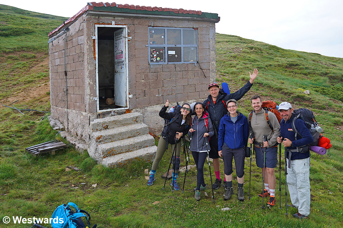
Quickly, the dark clouds turn into a thunderstorm, and rain forces us to seek shelter. Luckily the tiny ski-lift warden hut is open. Inside, a group of hikers from Skopje are already waiting out the storm. They have spent the night on Titov Vrv, the highest peak in the range, and share stories and a handful of dates and nuts with us while the rain hammers on the tin roof (and leaks in at some places).
When the sky finally clears, we continue towards the Antenna viewpoint. This stretch feels easy by comparison, following a broad track to the summit. But from there the descent turns wild again – cross-country on slippery slopes, with some more rain, hail, and the occasional rumble of thunder chasing us all the way down. Eventually we rejoin a dirt road that curves back beneath the ski lift and into Popova Shapka, where a hot cappuccino at Hotel Scardus is just what we need to warm up.
With no mobile signal in the village, hitchhiking turns out to be the easiest way back to Tetovo. In summer, plenty of visitors drive up to Popova Shapka, and locals are often quick to offer a ride down.
Where to stay and what to see in Tetovo
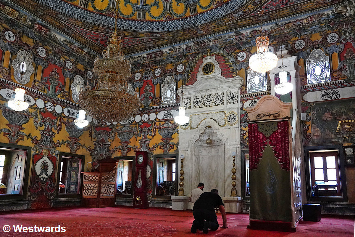
We stayed two nights at Hotel Lirak in Tetovo, which at around €50 per night was the priciest accommodation of our North Macedonia trip. The hotel felt a bit old-fashioned, but we found it comfortable and convenient. Tetovo’s main attractions include the Colourful Mosque, a 15th-century Ottoman gem famous for its vividly painted interior and exterior. It is definitely worth a visit, and women are welcome inside if they wear a headscarf. We also stopped by the Arabati Baba Tekke, a historic Bektashi Sufi monastery, though we found it slightly underwhelming compared to the mosque.
Hiking in the Mavrovo National Park
Hike from the village of Janče near Jovan Bigorski Monastery to the mountain village of Galičnik and back, 13 km, 900 m up and 900 m down
Mavrovo National Park is part of the UNESCO World Heritage site, Ancient and Primeval Beech Forests of the Carpathians and Other Regions of Europe. However the protected core zone is quite far from any public transport, making a day trip visit impossible.
One of the few hikes in Mavrovo National Park (and one of the most scenic day hikes in North Macedonia) you can do (more or less) by public transport starts not far from the Jovan Bigorski Monastery, one of the country’s most striking religious sites.
Starting at the Jovan Bigorski Monastery
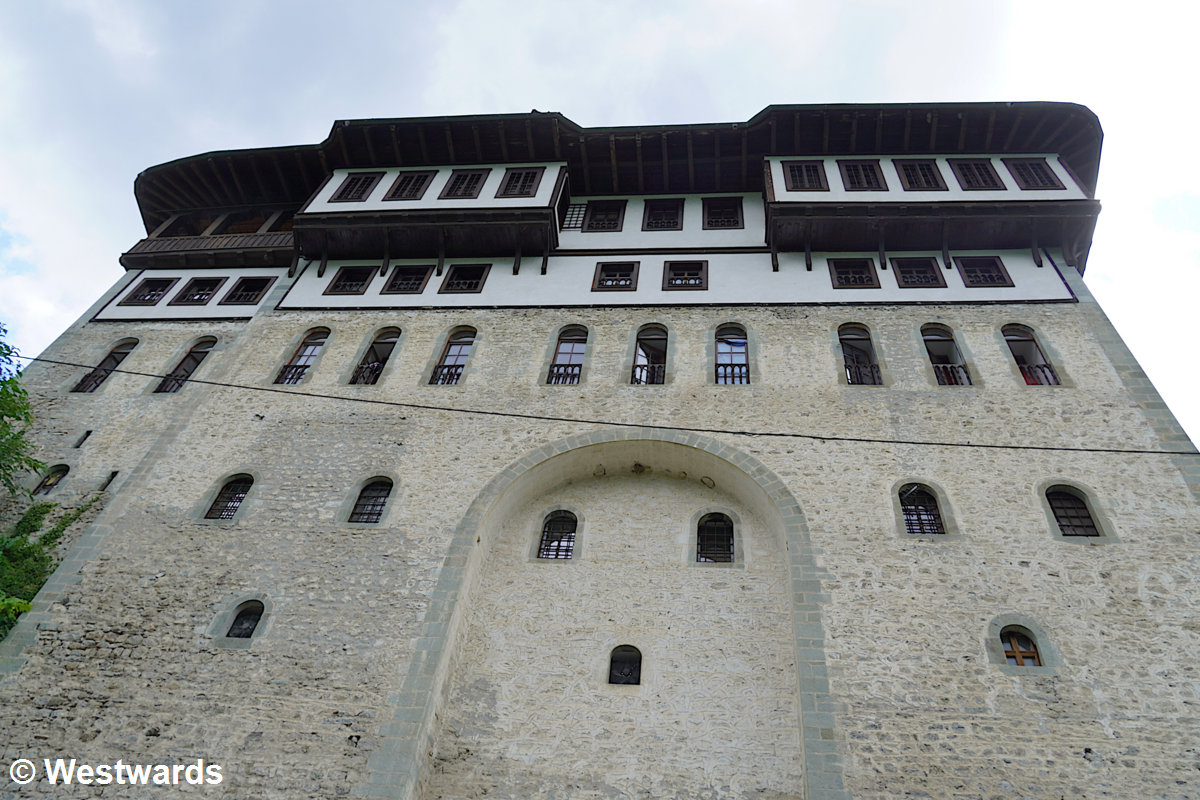
The monastery is perched above the Radika valley, its tall stone walls and wooden living quarters giving it the look of a fortress. We have booked a room in the pilgrims’ guesthouse, and after dropping our bags, we quickly change into hiking clothes and set off. This way we are hoping to get a good headstart before the already conspicuous afternoon rain clouds roll in.
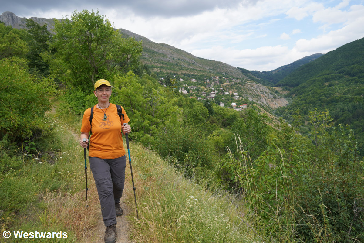
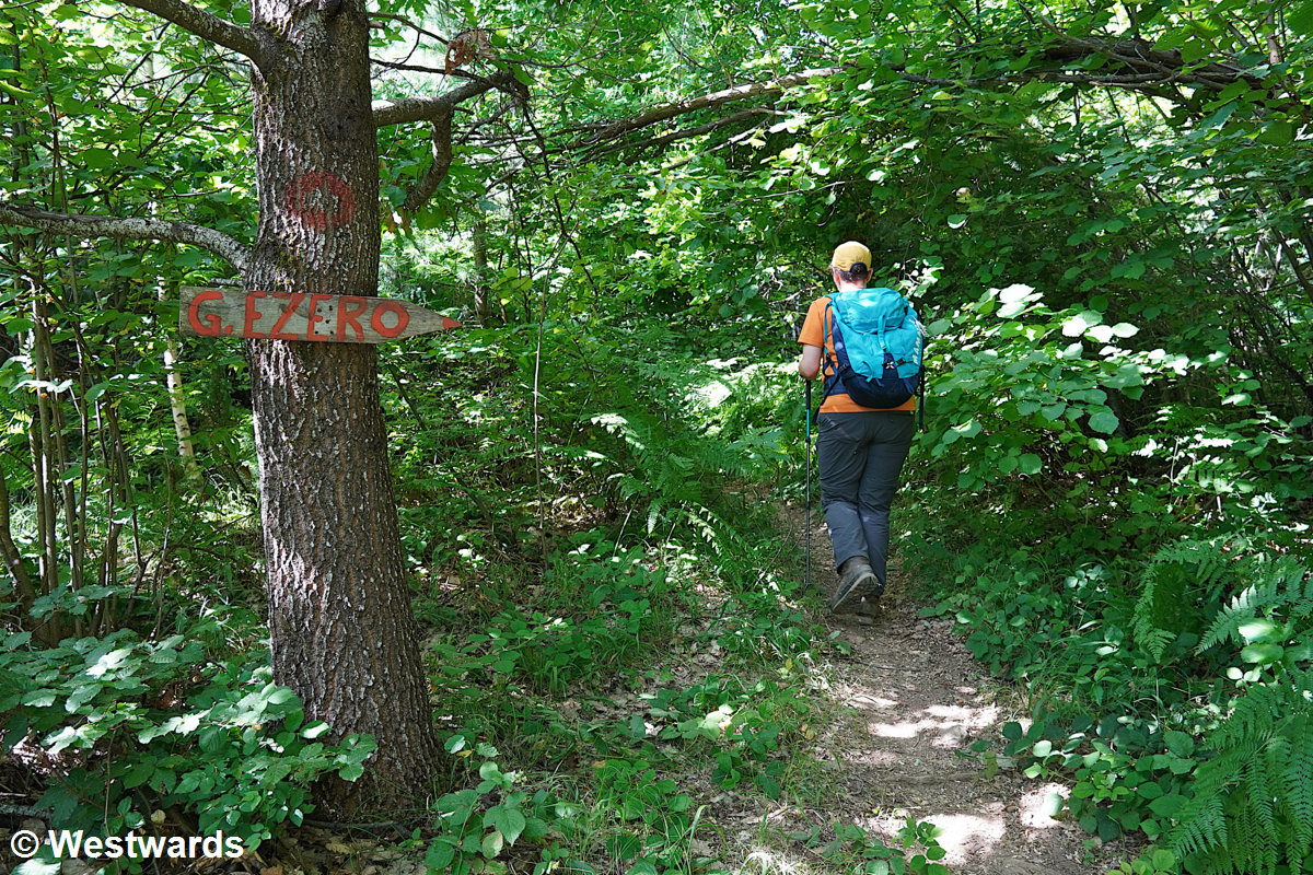
The village of Janče, where the actual trail starts, is 6 km along the valley. Therefore, we hitch a ride down the road – first with a local to Rostuše, then with a Belgian couple heading to Ohrid who drop us at the Janče junction. From there, a steep but lovely walk leads up to Janče, a sunlit hill village of stone houses, wooden balconies, and tower-like homes that could almost be in Tuscany.
An elderly man is slowly making his way uphill with nine kilos of bell peppers and a bag of groceries. We offer to help, and he accepts with a smile, insisting we stay for coffee once we reach his house. But with the sky darkening, we hesitate. “Rennen?” he suggests with a grin. In German, this means: “Run?” And so we do, setting off at a brisk pace up the mountain.
The Trail to Galičnik
We soon pick up the official hiking route toward Galičnik. The GPX track from the national park’s official website turns out to be unreliable. It shows a footpath that’s now completely overgrown; but the main dirt road winds steadily upward in broad switchbacks. OpenStreetMap proves to be a much better guide.
As the track enters the forest, the trail grows rougher – overgrown in places, yet still easy enough to follow. The zigzags steadily climb through the woods before emerging below a line of cliffs, where far-reaching vistas open up over the Radika Valley.
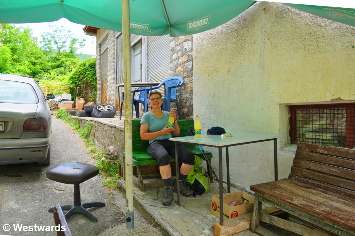
The mountain village of Galičnik sits high on a ridge. It is famous for its traditional Mijak architecture – thick stone houses with wide wooden balconies – and for its legendary Galičnik Wedding Festival each July. The picturesque church at the top of the village is closed, alas! But outside we find a tiny shop with a few chairs and a table. A couple of old men sit on a bench beside stacked crates of beer. We join them for a bottle of Schweppes Bitter Lemon and watch the dark clouds drift past, a little faster than we’d like.
The hike back follows the same route – long but gentle, the kind of descent that lets your thoughts drift. By the time we reach Janče, the air smells of damp earth, though the rain still holds off. A friendly driver from Skopje picks us up. He’s of mixed Macedonian and Serbian background, and although we don’t share a common language, we still manage a kind of conversation.
Where to stay and eat
We stayed at the pilgrims’ hostel of the Jovan Bigorski Monastery in a simple room with shared bathrooms. There’s no dinner or breakfast service, but a good restaurant is just down the road. If you spend the night at the monastery, don’t miss the morning mass at 6:30! It’s a beautiful service where the monks sing almost the entire liturgy in haunting harmony.
For another unforgettable monastery stay, check out our post about Studenica Monastery in Serbia.
Hiking to the Golemo Ezero in Pelister National Park
13 km, 1100 m up and 1100 m down
If you’re looking for a proper day hike in North Macedonia – one with a mix of forest mystery, mountain drama, and the occasional insect attack – Pelister National Park is the place to go. Our destination for the day: Golemo Ezero. The “Big Lake” is high up in the Baba Mountain range near the town of Bitola.
As usual, there’s no bus heading into the national park (apparently the concept of “public transport to hiking trails” hasn’t quite made it to North Macedonia yet). But by now we know that taxi rides in North Macedonia are easy to handle. There is never a need to haggle, and no inflated tourist prices. The drivers stick to an official price list they consult for each destination. So, off we go by taxi to the upper part of Nižepole village, where the hiking trail starts.
Hiking up through the trees
At first the path meanders through the forest – a soft, green tunnel of trees. But soon there are old trails, new trails, unofficial shortcuts, and mysterious side paths that lead absolutely nowhere. Naturally, we manage to end up on the wrong path several times. The “old trail” turns out to be more of a botanical adventure than a hike: waist-high ferns, thorny branches, and the kind of overgrowth that makes you question your hiking choices. But there are tiny red strawberries and mountain blueberries along the way. Eventually, after some sweating, scratching, and muttering, we find the proper trail again. Finally above the tree line, the panorama opens. The air feels lighter, the views stretch toward Greece, and the hiking suddenly becomes easy and joyful. We pass three crystal-clear springs, all with potable water.
A rest at the Pelister Mountain Hut
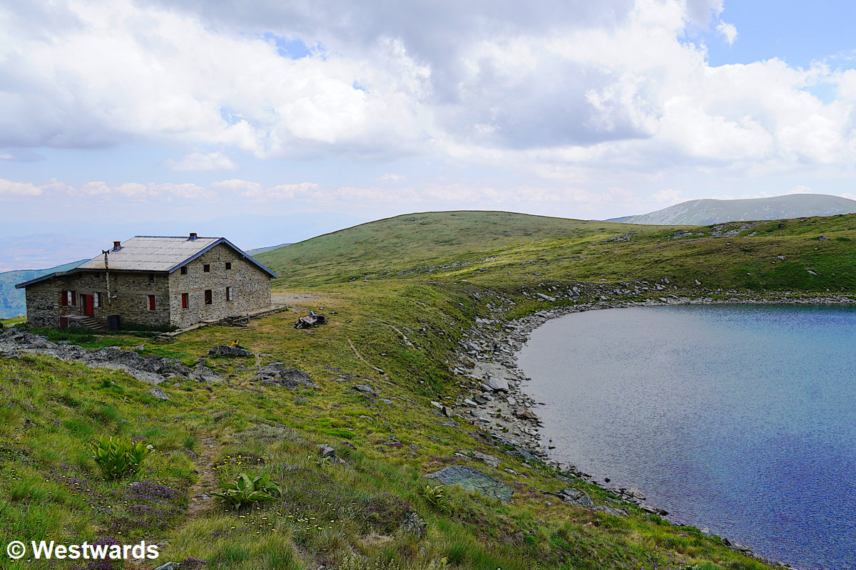
And after a steep push through alpine meadows, we spot the Pelister Hut. Right beside it lies the shimmering blue Golemo Ezero Lake. Behind the hut and the lake, a rocky wall rises – a perfect postcard sight.
The hut is quite lively already and the hut warden is expecting more guests in the evening. We have a look around the guest room (also doubling as a drying room for fragrant mountain tea) and the kitchen where a group of girls is busy chopping vegetables. A few brave hikers have even gone swimming in the icy lake. Their towels and swimsuits are drying in the mountain sun.
After a rest and a snack, we start our descent. Going back feels easier – not least because this time, we manage to stick to the proper trail. The only downside are a lot of annoying flies and horseflies. Natascha ends up with several impressive red swollen bites.
By about 3 pm, we’re back in the village and lucky enough to quickly find a ride back to Bitola. Our driver, a friendly local with a weekend dacha in Nižepole, chats about skiing and his business trips to Germany.
Where to stay and eat in Bitola
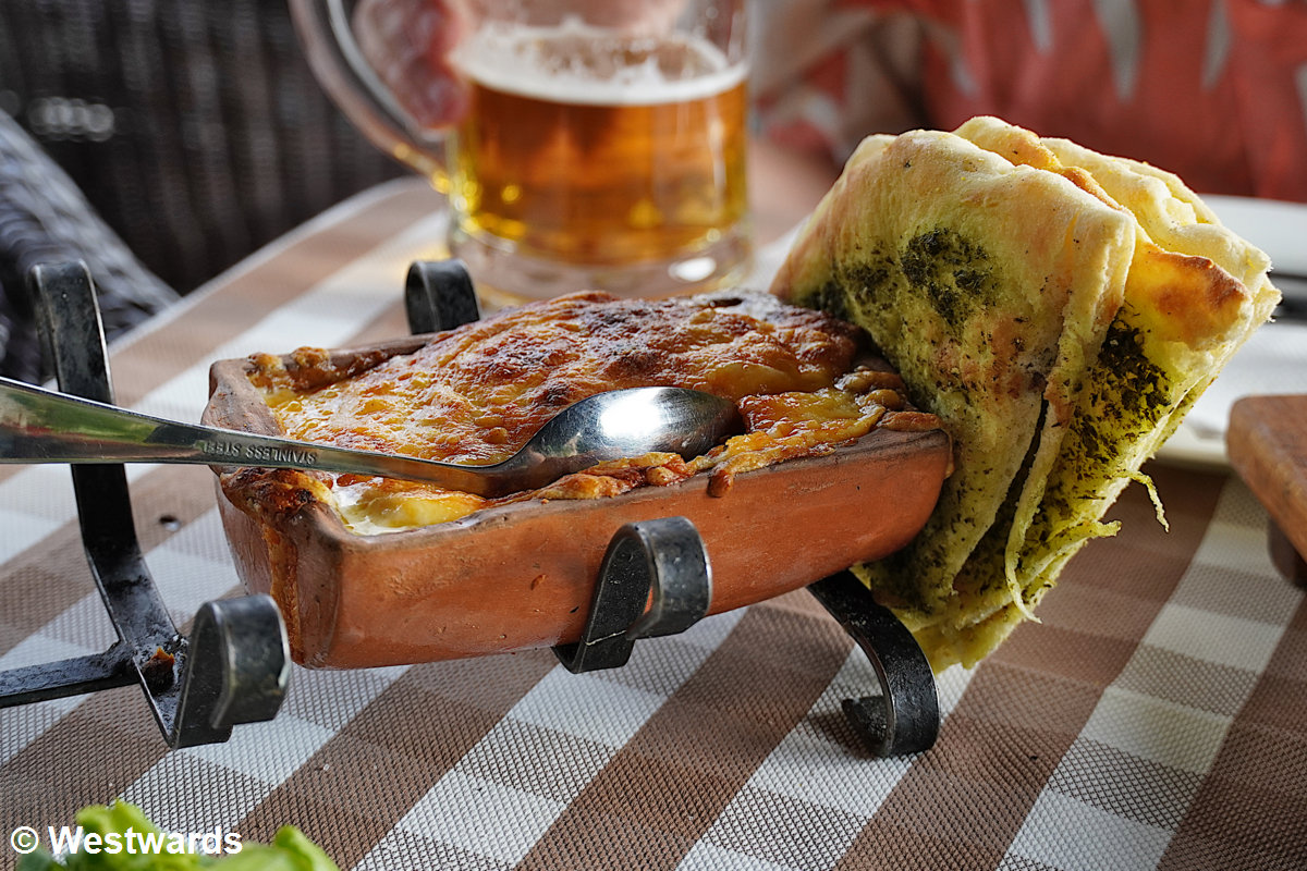
Bitola is a great base for hiking in Pelister National Park and exploring the southern part of North Macedonia bordering Greece. After the hike, we treated ourselves to a hearty local cheese dish (the kind that could power another mountain climb) and a glass of Macedonian wine. Well-earned rewards after one of the best day hikes in North Macedonia.
How to Organize Your Day Hikes in North Macedonia
Most North Macedonian hiking trails start near small mountain villages or monasteries, with limited public transport. Taxis are reliable, affordable, and often the most practical way to reach trailheads.
Important: Download offline maps (for instance on OsmAnd or Komoot) before you go, since phone signal is spotty in the mountains.
Take enough water! Maps are not very detailed. Therefore it is difficult to find out whether there is drinking water available along the hike. We saw a lot of cattle, for example during the hike in the Shar mountains. Therefore, drinking water from rivers is not advised.
Even if you have a GPX trail downloaded from the internet, do not count on it too much. It may have been cross-country in the first place, and even proper trails may become overgrown in a season or two.
Have you ever hiked in North Macedonia? Share your tips or favorite trails in the comments below!
NB: We were not sponsored to write this blog post in any way and paid all expenses ourselves.
Never miss a new post! Get notifications about new posts straight into your inbox!
Why don’t you save this post for later? Use this pin: